


Voting District CF01, New Hanover County, North Carolina
About
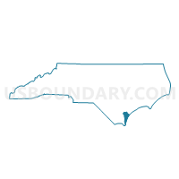
Outline

Summary
| Unique Area Identifier | 640969 |
| Name | Voting District CF01 |
| County | New Hanover County |
| State | North Carolina |
| Area (square miles) | 27.62 |
| Land Area (square miles) | 23.43 |
| Water Area (square miles) | 4.20 |
| % of Land Area | 84.81 |
| % of Water Area | 15.19 |
| Latitude of the Internal Point | 34.29230980 |
| Longtitude of the Internal Point | -77.96171420 |
Maps


Graphs
Select a template below for downloading or customizing gragh for Voting District CF01, New Hanover County, North Carolina


Neighbors
Neighoring Voting District (by Name) Neighboring Voting District on the Map
- Voting District 02, Brunswick County, NC
- Voting District 03, Brunswick County, NC
- Voting District 04, Brunswick County, NC
- Voting District CF02, New Hanover County, NC
- Voting District CF03, New Hanover County, NC
- Voting District GR06, Pender County, NC
- Voting District W03, New Hanover County, NC
- Voting District W25, New Hanover County, NC
Top 10 Neighboring County Subdivision (by Population) Neighboring County Subdivision on the Map
- Wilmington township, New Hanover County, NC (106,476)
- Town Creek township, Brunswick County, NC (27,533)
- Cape Fear township, New Hanover County, NC (18,388)
- Northwest township, Brunswick County, NC (12,190)
- Grady township, Pender County, NC (2,368)
Top 10 Neighboring Place (by Population) Neighboring Place on the Map
- Wilmington city, NC (106,476)
- Wrightsboro CDP, NC (4,896)
- Skippers Corner CDP, NC (2,785)
- Navassa town, NC (1,505)
- Hightsville CDP, NC (739)
- Blue Clay Farms CDP, NC (33)
Top 10 Neighboring Unified School District (by Population) Neighboring Unified School District on the Map
- New Hanover County Schools, NC (202,667)
- Brunswick County Schools, NC (107,431)
- Pender County Schools, NC (52,217)
Top 10 Neighboring State Legislative District Lower Chamber (by Population) Neighboring State Legislative District Lower Chamber on the Map
- State House District 17, NC (94,557)
- State House District 16, NC (93,684)
- State House District 18, NC (72,850)
Top 10 Neighboring State Legislative District Upper Chamber (by Population) Neighboring State Legislative District Upper Chamber on the Map
Top 10 Neighboring 111th Congressional District (by Population) Neighboring 111th Congressional District on the Map
Top 10 Neighboring Census Tract (by Population) Neighboring Census Tract on the Map
- Census Tract 115, New Hanover County, NC (7,990)
- Census Tract 116.03, New Hanover County, NC (7,436)
- Census Tract 202.02, Brunswick County, NC (5,719)
- Census Tract 201.04, Brunswick County, NC (5,305)
- Census Tract 201.01, Brunswick County, NC (2,706)
- Census Tract 9205.02, Pender County, NC (1,717)
- Census Tract 114, New Hanover County, NC (1,420)
- Census Tract 113, New Hanover County, NC (1,399)
- Census Tract 9801, New Hanover County, NC (2)